First Alert Forecast: Warmer, sunny start to the week
FORT WAYNE, Ind. (WPTA) - While still chilly, Sunday night is not quite as cold as the night prior with lows in the upper 30’s. We hold onto a mostly clear sky overnight, leading into a Monday that will feature plenty of sunshine along with a couple of passing clouds at times.
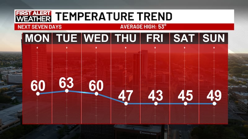
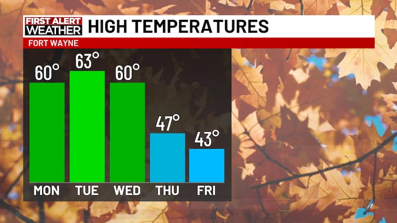
We enjoy some warmer weather to kick off the workweek. Temperatures near the 60-degree mark Monday afternoon, and Tuesday appears to be the warmest day of the week with highs reaching the mid 60’s.
We enjoy a lot of sunshine on Tuesday, but cloud coverage begins to fill-in Wednesday as we see the return of rain chances by Sunday afternoon. A lot of uncertainty still exists regarding this system, but scattered showers are possible Wednesday night into Thursday as a low-pressure system moves across Indiana. Overnight lows dip to just below freezing Thursday night, but our rain chances should clear up by this time.
After one more mild day Wednesday, we close the week with highs in the lower-to-mid 40’s. While much cooler, some sunshine will remain around the region and we will enter next weekend on a dry note.
Copyright 2026 WPTA. All rights reserved.