First Alert Forecast: 60s for now... bigger temperature drop soon
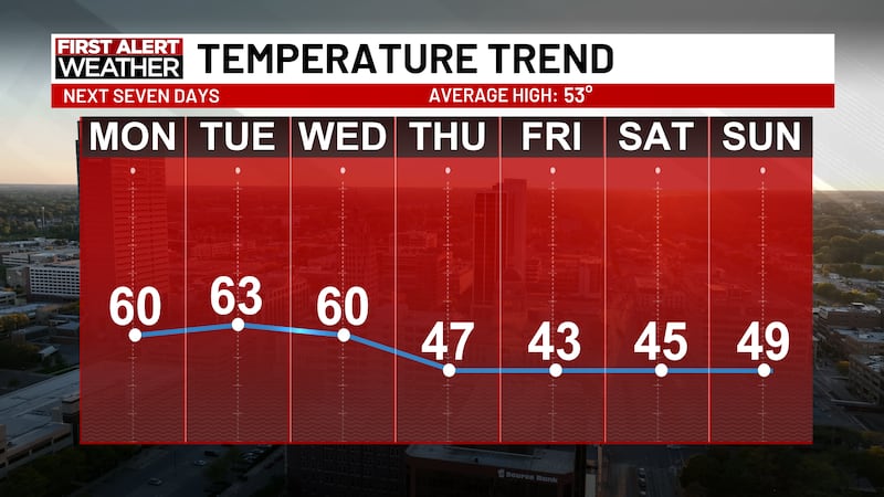
FORT WAYNE, Ind. (WPTA) - Enjoy the mild weather while it lasts: A colder pattern arrives later this week, sending highs from the 60s into the 40s.
Sunny & 60s to Start the Week
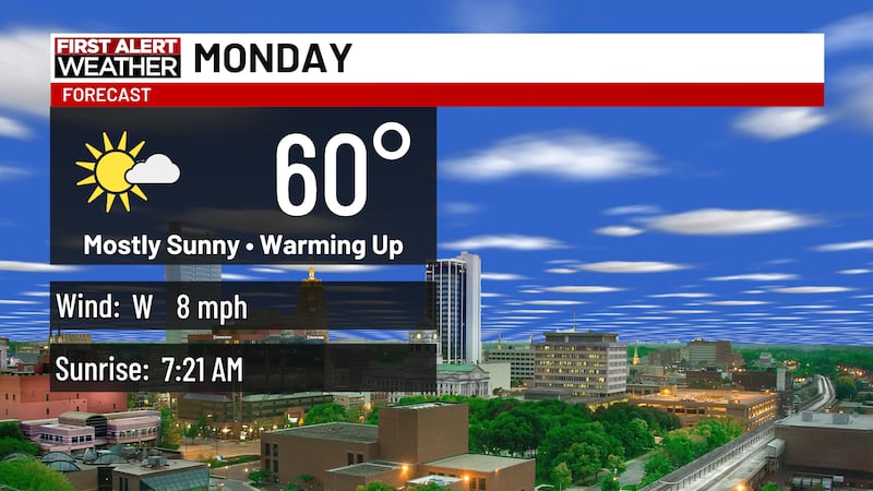
The week begins with sunshine and a slight warmup from the weekend’s 50s. Highs will reach around 60 degrees Monday afternoon, with more sunshine and temperatures in the low 60s Tuesday. Both days offer great opportunities to get outside.
Getting Cloudy Wednesday
Veterans Day on Wednesday will remain mild, with highs in the upper 50s to low 60s, but clouds will move in. A few stray showers are possible late Wednesday evening and overnight.
Dropping Temperatures... First Flakes of the Season?
The bigger temperature drop arrives Thursday and continues into the weekend, with highs only in the 40s. A few rain showers are possible late Thursday, and as overnight temperatures fall to around freezing, some of the season’s first snowflakes could mix in.
Any snow would likely arrive late at night, and warm ground temperatures should keep it from accumulating. Still, it’s a reminder of just how much the weather can change from the sunshine and 60s at the start of the week.
The Breakdown
- Monday: Sunny. High of 60.
- Monday night: Clear. Low of 41.
- Tuesday: Sunny. High of 63.
- Wednesday: Mostly cloudy, with a few showers late in the day. High of 60.
- Thursday: Mostly cloudy, with a few late showers. Snowflakes could mix in overnight but are expected to melt. High of 47.
- Friday: Partly to mostly cloudy. High of 43.
- Saturday: Partly cloudy. High of 45.
- Sunday: Partly cloudy. High of 49.
Copyright 2026 WPTA. All rights reserved.