First Alert Forecast: 60s to end the week, gusty weekend in store
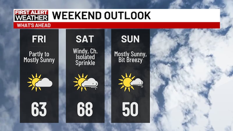
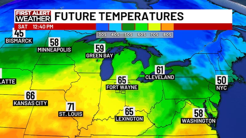
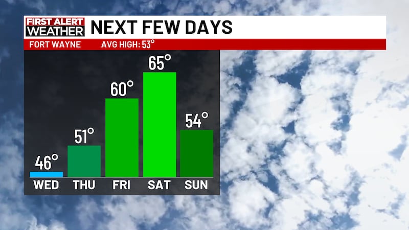
FORT WAYNE, Ind. (WPTA) - We continue to warm up to end the week, as highs return to the 60s this afternoon. We stay dry and sunny this afternoon, but cloudy coverage returns tonight and tomorrow. Just a few days removed from wind chills in the teens and snow on the ground we will push into the mid to upper 60s by tomorrow. A cold front arrives late tomorrow which will ramp up our wind gusts to 30mph this weekend, and temperatures drop into the lower 50s by Sunday.
We want to give you a First Alert to a system we are watching for next week, set to arrive in the middle to late part of the week. There will be plenty of time for change over the next week, but as it stands, we could be in for some rain showers around Christmas on Broadway. We will continue to track this system and give you the latest as we get closer to Christmas on Broadway.
Copyright 2025 WPTA. All rights reserved.