First Alert Forecast: 60s Friday, 70º possible Saturday
FORT WAYNE, Ind. (WPTA) - High temperatures today rose effortlessly into the 50s with noticeably lighter wind, and Friday promises to be even warmer with highs likely exceeding 60º by midday under mostly sunny skies. As a plus, the wind will remain light.
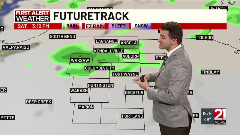
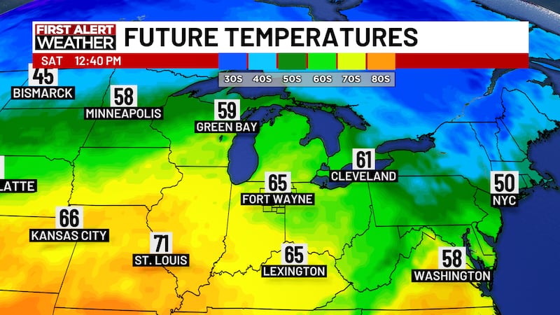
Clouds will increase Friday night as a warm front pushes through the area, slinging highs into the upper 60s to low 70s Saturday afternoon! It will be windy, though, with gusts likely exceeding 30 mph. A cold front will sweep through at night, leading to a sunnier, but cooler, Sunday with highs back into the upper 40s. Wind gusts will be a bit lighter, but still in the 20-30 mph range.
While Monday of next week looks dry, I am watching our next system Monday night into Tuesday. Right now, it looks like there could be enough cold air (low 30s) early Tuesday morning for some of the incoming rain to start as a rain/snow mix. Impacts would likely be minimal as temperatures are expected to warm into the low 40s by Tuesday afternoon, but it bears watching!
Copyright 2025 WPTA. All rights reserved.